Evidence contradicting denial of responsibility by Israel for the attack on a displaced people convoy in Gaza


Gaza Strip has been subject to horrific attacks by the Israeli army since the beginning of October 2023, resulting in massive human losses, unprecedented destruction of infrastructure and the eradication of entire populated residential areas. Even convoys of displaced people were not spared from these attacks, as one of them was subjected to multiple attacks along Salah al-Din Street near Kuwait Roundabout on the afternoon of Friday, 13 October 2023, during the evacuation towards the south at the request of the Israeli army. At least three of these attacks directly hit cars along the road carrying displaced people, and shrapnel also hit a truck with two trailers carrying displaced people. The attacks killed 70 people and injured more than 200 others. The Israeli army, through its official spokesman, presented a misleading narrative in an attempt to shift responsibility for the attack from Israel, using a video clip of another incident at a different location and time to deny its responsibility for the incident.
The video presented by the Israeli army refers to an explosion filmed on Wadi Gaza Bridge, about 4 kilometres away from the site of Salah al-Din Street attack. Analysing the shadow of the video clip, it appears that it was taken at 14:59 local time in Gaza City, while the first report about Wadi Gaza incident was published at 16:04 local time in Gaza City.
Based on examining the data we have about the two attacks; it can be confirmed that Wadi Gaza Bridge incident is completely different from the multiple attacks that targeted Salah al-Din Street near Kuwait Roundabout on a convoy of displaced people. Widely using the video out of context by media and fact-checking platforms led to a misunderstanding about the nature of the two incidents, and as a result the official spokesman for the Israeli army used these analyses to deny Israel’s responsibility for the attack.
NAWA Media Open-Source Investigations Team monitored and analysed open source content related to the attacks on the displaced people’s convoy on 13 October, and also analysed the events and contexts of the relevant visual materials, to prepare this investigation, which aims to uncover the circumstances of the attack and try to determine the party responsible for it.
Evacuation order
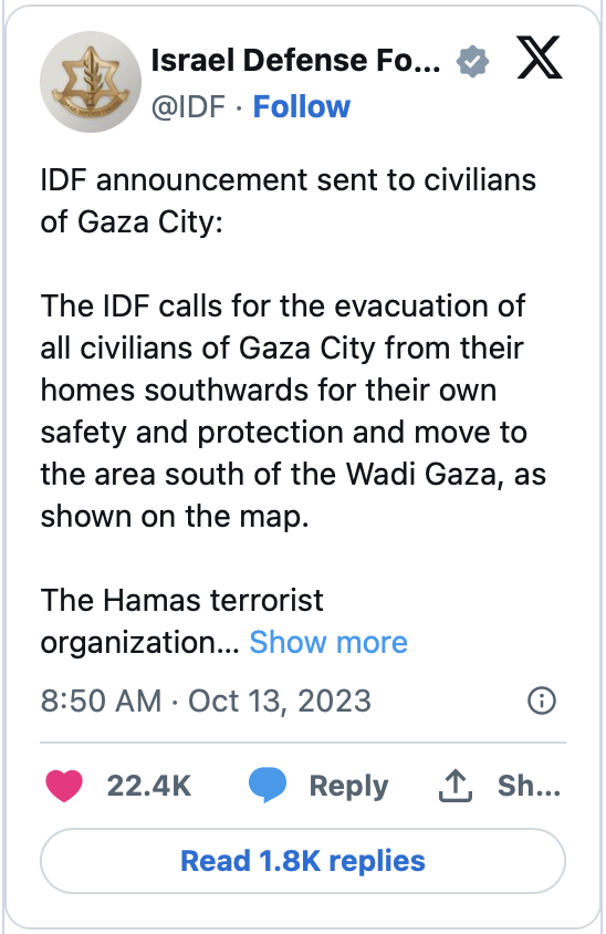
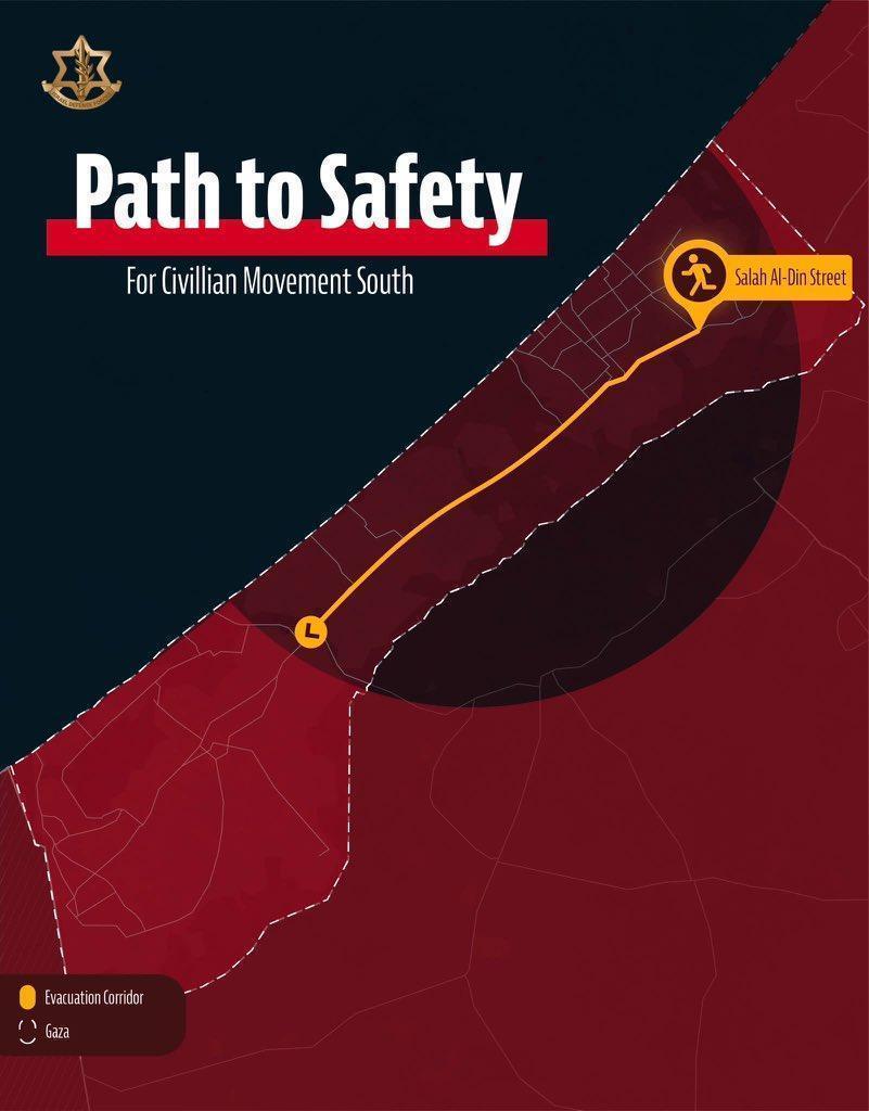
The “Israeli Army” account on X (formerly Twitter) published a warning post to residents of northern Gaza on the morning of 13 October 2023, stating the need for the evacuation of all civilians of Gaza City from their homes southwards for their own safety and protection and move to the area south of the Wadi Gaza.
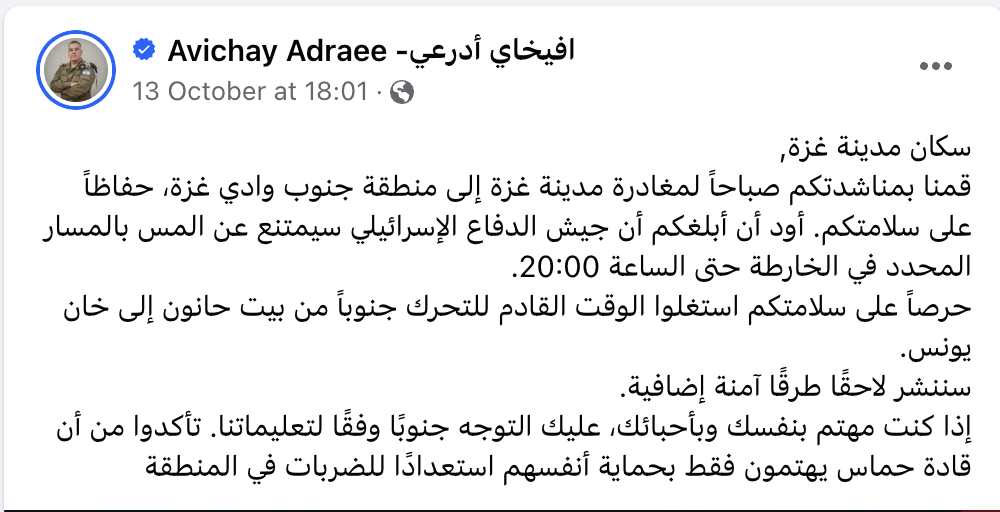
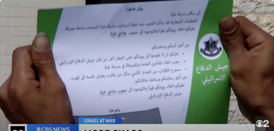
The IDF’s official spokesman, Avichai Adraee, also shared on his Facebook page the same evening of 13 October 2023, an update to the evacuation announcement, adding: “We appealed to you in the morning to leave Gaza City to the area south of the Gaza Valley, for your safety. I would like to inform you that the IDF will refrain from touching the route marked on the map until 20:00. This was the only announcement on the Internet that provided information about the designated displacement route.
What happened?
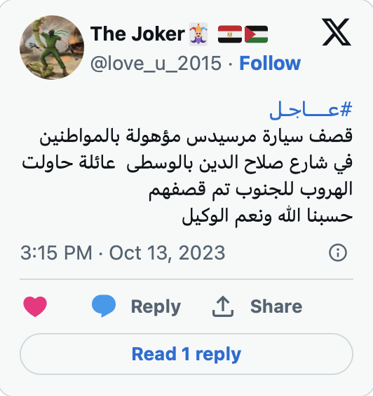
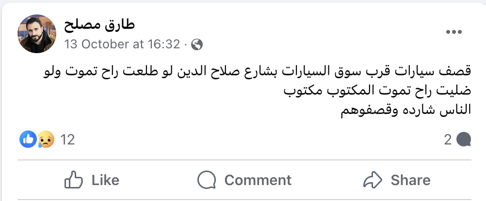
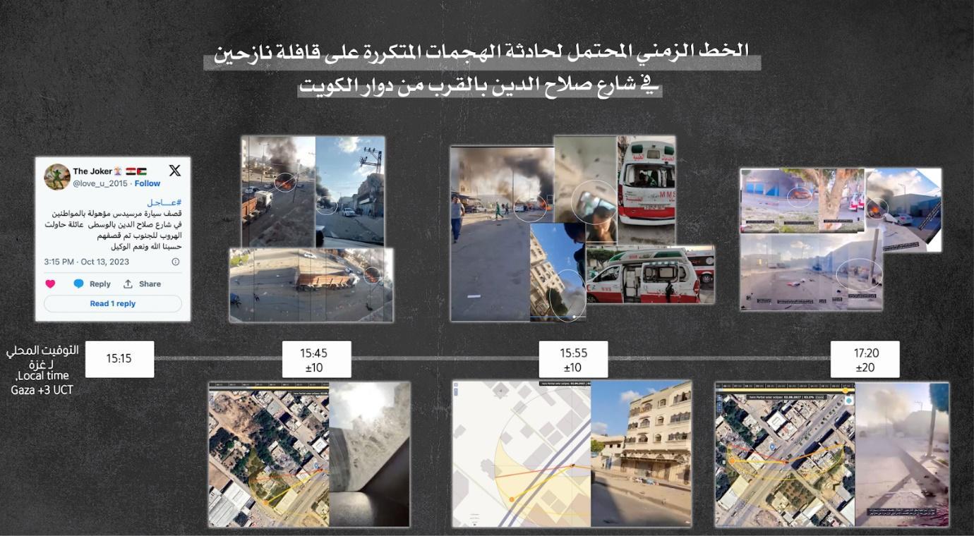
A user named The Joker posted on X at 15:15 local time in Gaza about the bombing of a Mercedes car full of civilians on Salah al-Din Street in the centre of Gaza Strip after they tried to leave and head south. Tariq Mesleh’s account also posted at 16:32 local time in Gaza: “Cars were bombed near the car market on Salah al-Din Street… People were astray and they bombed them.” In addition to an account named Nermin, who posted a question, “What is happening in Zaytoun neighbourhood? News about massacres” at 16:55. According to our analysis, the three accounts were the first to publish about the attack.

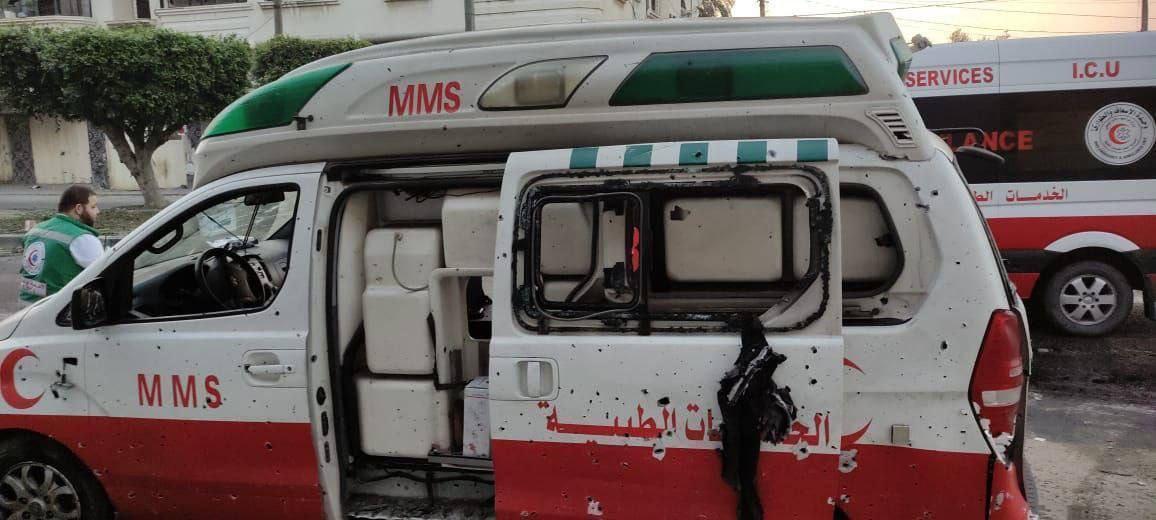
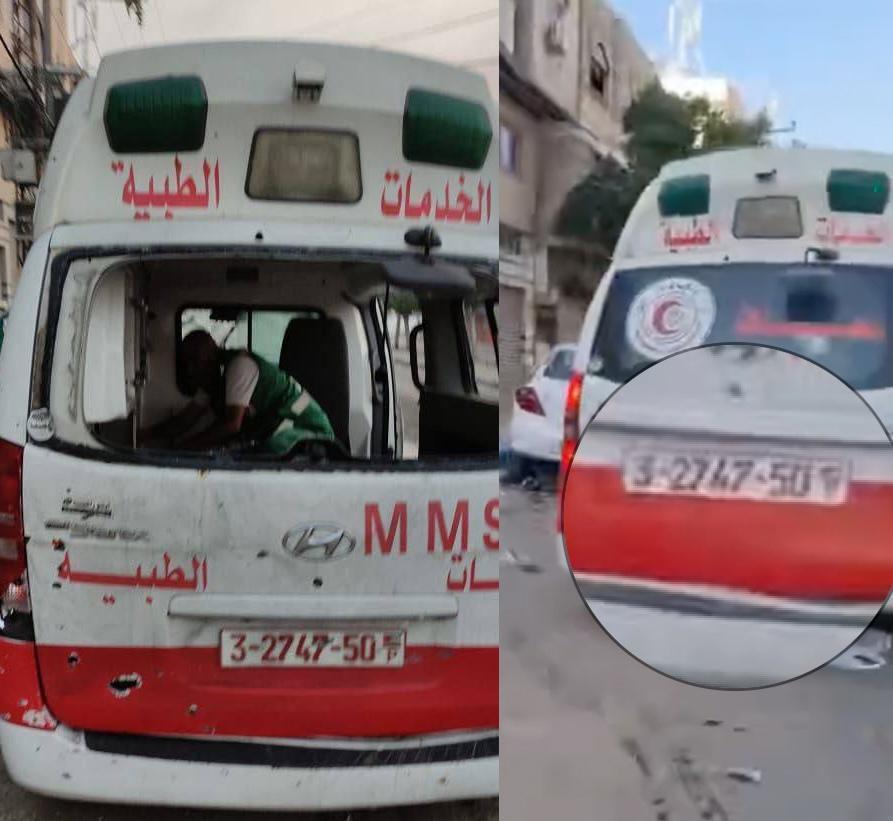
At 7:00 pm on the same day, the official announcement came from the Palestinian government media office about the Israeli army’s bombing of several cars carrying displaced people heading towards southern Gaza. A video published by the Palestinian Ministry of Health/Gaza showed an ambulance driver whom it described as “a witness to a real massacre,” collapsing and kneeling on the ground as he arrived at the hospital, speaking to the camera and saying, “Advise the people to go to their homes, they bombed the people who are stray in trucks,” explain that displaced people on trucks were bombed. He continued, “They told the people to be displaced and bombed them.” Someone next to him added that trucks and ambulances were also bombed.
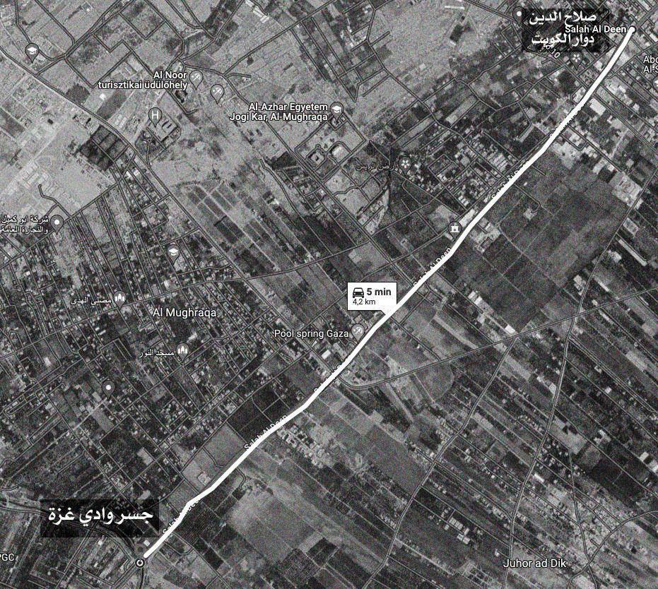
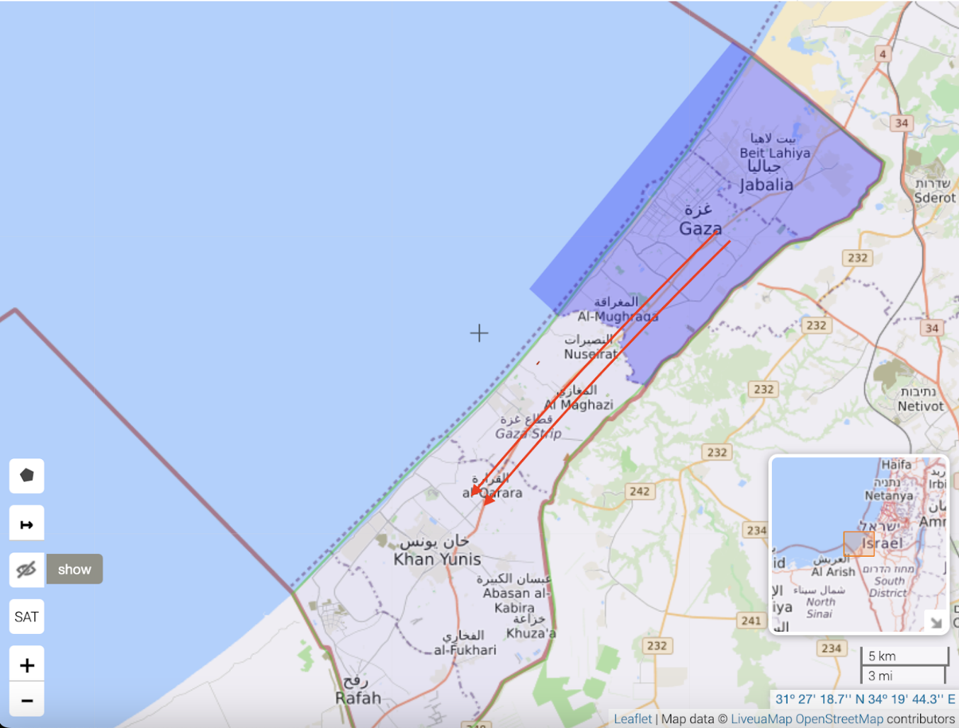
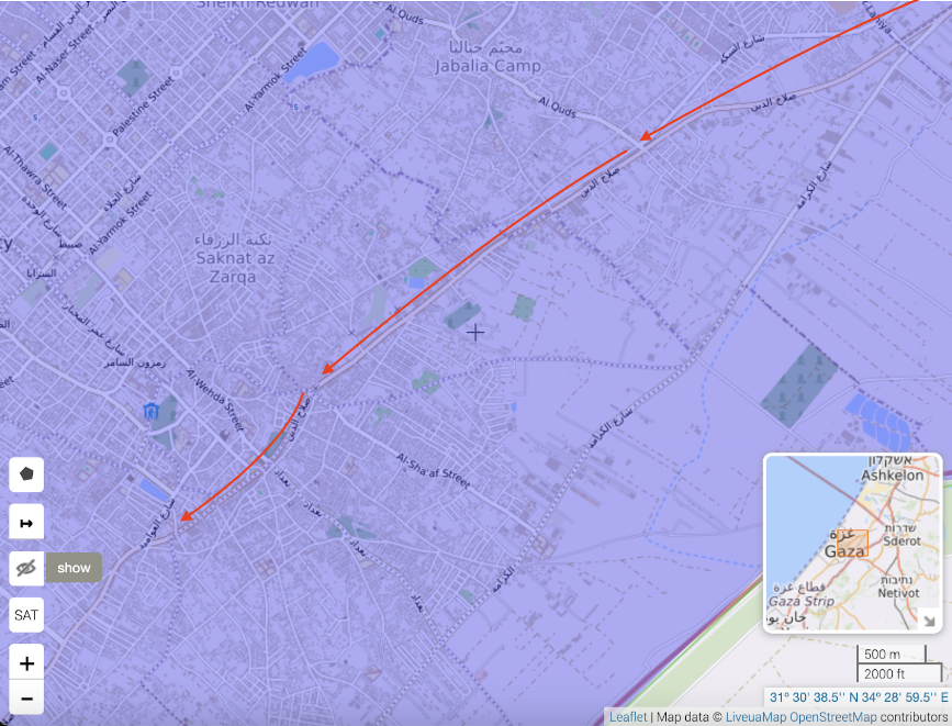
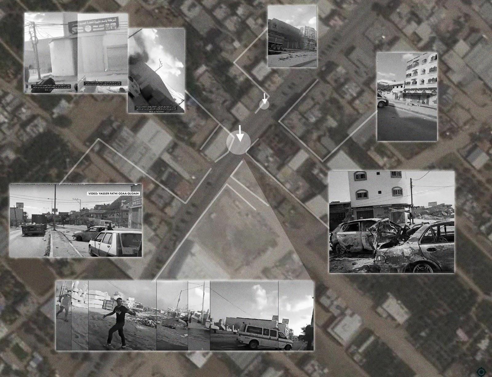
Geographical location: Where did the attack take place?
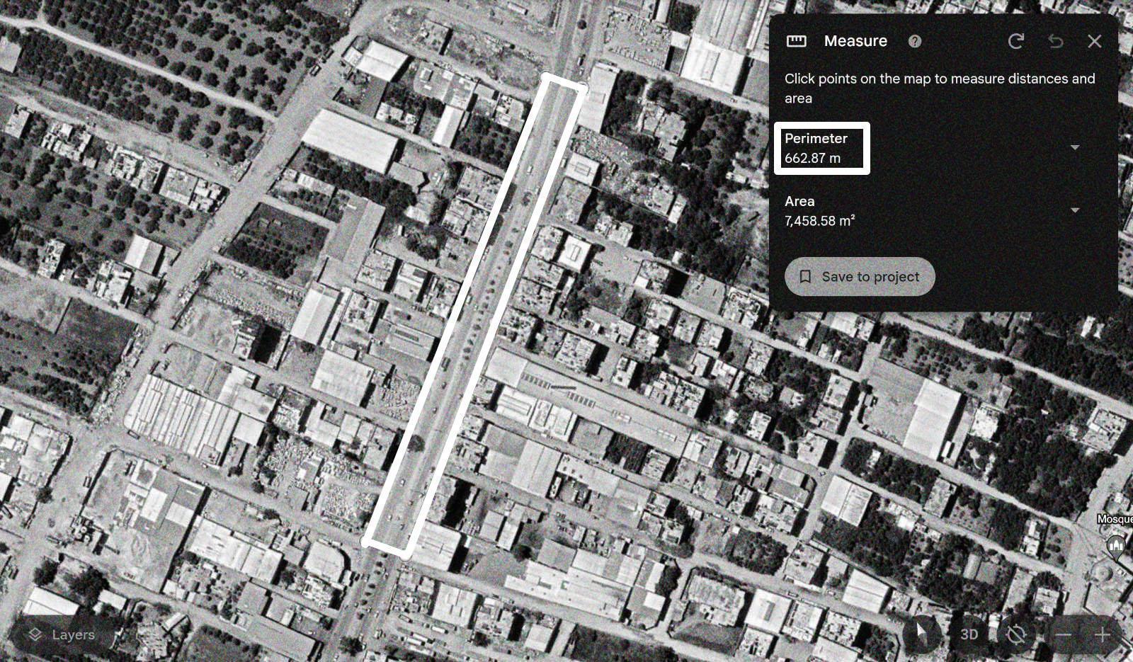
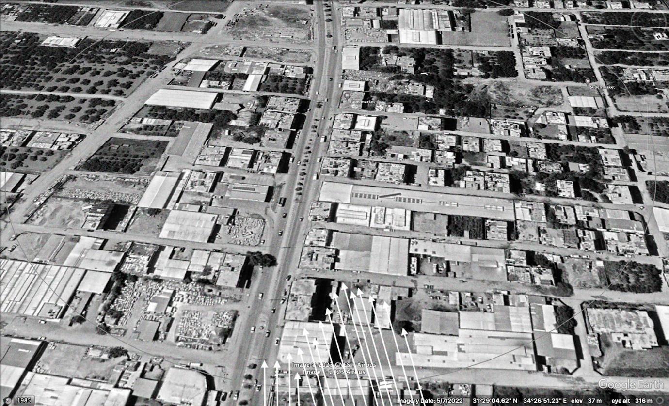
By analysing and matching the visual content of videos published by the Palestinian Ministry of Health/Gaza, journalist Ragıp Soylu, as well as Local Focus and other videos online, it was possible to determine the coordinates of some of the clear strikes that were documented, an attack on a group of cars behind the two trailers next to Aslim Petrol Station on Salah al-Din street near Kuwait Roundabout in Gaza City, specifically at coordinates 31.483005, 34.444769.
And another attack minutes later, a few meters away, hit a car in front of Daghmush Trading and Tire Repair Company stores, next to the ambulance crews after they arrived at coordinates 31.483354, 34.445045. It cannot be confirmed that these were the only two attacks, as the number of attacks may be much higher.
When did the attack happen?
Following The Joker’s post that a bombing targeted a car on Salah al-Din Street, various websites and accounts published videos of the incident. Based on the movement of the shadow using SunCalc tool and the timeline of damage resulting from successive strikes on the incident site shown in these videos, we were able to arrange the events and create a possible scenario for them.
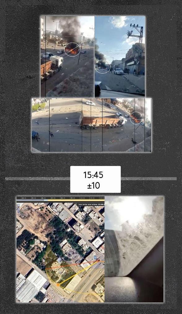
Journalist Khaled Iskif published a video filmed from the top of one of the buildings in the area of the incident. The footage shows two burning cars, flames rising from them, and two cars next to them, but the extent of their damage is not shown. By comparing the video with a video published by Palestinian Ministry of Health/Gaza, it appears that they were filmed at the same moment from two different angles. By analysing the shadows of one of the video clips, it appears that the likely time of filming was approximately 15:45 ± 10 local time in Gaza City.
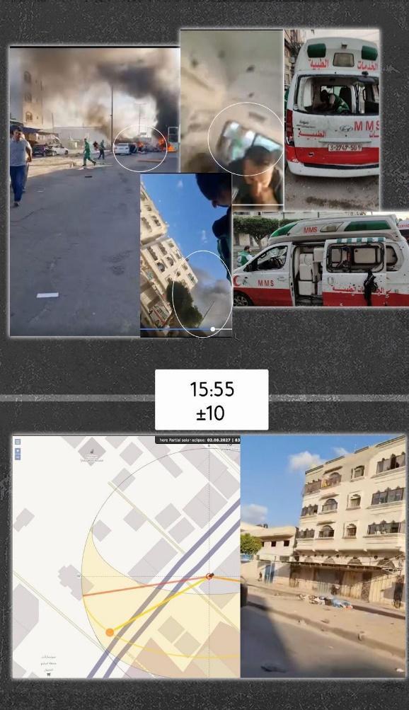
Palestinian Ministry of Health/Gaza published another video documenting three close attacks seconds apart, one of which was a direct attack on a car parked to the side of the ambulance, damaging it and injuring two ambulance crew members who appeared at the end of the previous video. “An injury to the foot and another to the head.” By analysing the shadow of one of the shots, it is possible to estimate the time the video was shot, which is approximately 15:55 ± 10 local time in Gaza City. It should be noted that the footage appeared to show the fire in one of the two cars that appeared in Iskif video dying down, and showed the burning of a new one, perhaps “the grey car,” and this provides the possibility that an attack had occurred between the time Iskif video was taken and the Ministry of Health video.
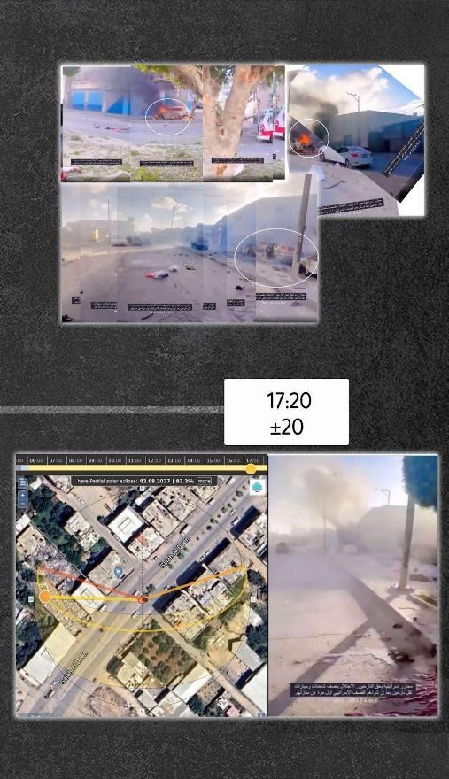
Finally, a published video appeared to have been taken some time after the bombing of the ambulance crew. It showed the group of burning cars, in addition to the car next to the ambulance, burning, and its smoke had decreased, and its colour had changed, with all the tires burned. It could be seen that there was a body of a person in the middle of the road who might have been hit by shrapnel from the projectile explosion that fell next to the ambulance.
By analysing the shadow of one of the shots in the video, the time can be estimated at approximately 17:20 ±20 local time in Gaza City.
It is not possible to confirm the timing that we reached through shadow analysis due to the inaccuracy of the positions of the photos taken of the shadow and the differences in results in the analysis, but we can conclude that the likely time of the multiple attacks on a convoy of displaced people on Salah al-Din street near Kuwait Roundabout was between 15:15 and 17:17: 20 Gaza City time, one of these attacks documented three strikes seconds apart.
Impact of the attack
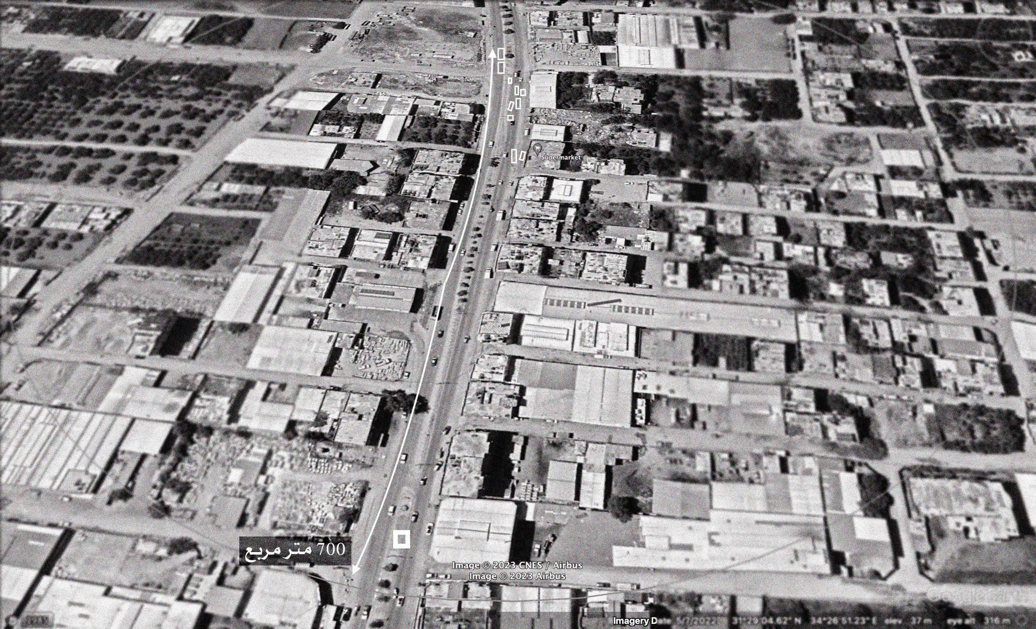
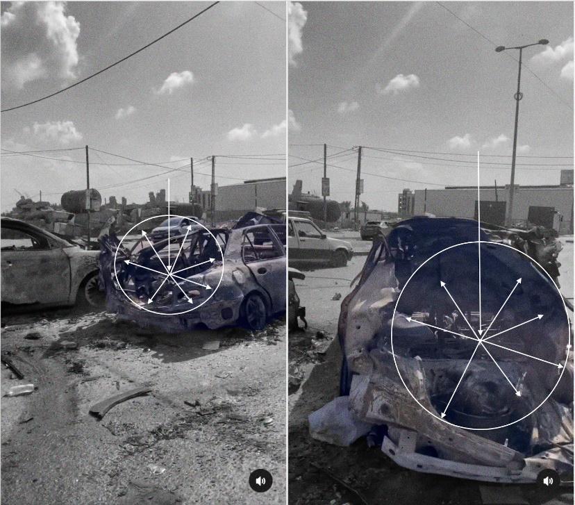
Considering the time context and visual content of the attack, it can be assumed that the bombing was random [1] in one direction along the impacted Salah al-Din Street, as most attacks were within a distance of about 700 square metres.
The bombing burned and destroyed 6 passenger cars, and several other cars parked nearby were damaged, in addition to the ambulance, which was damaged by shrapnel from the projectile that fell next to it. 7 bodies of civilians can be seen scattered along the street. As a result of the attack, 70 people were killed and more than 200 wounded, according to what Al Jazeera website reported, citing the Palestinian Ministry of Health. The Ministry did not publish their names.
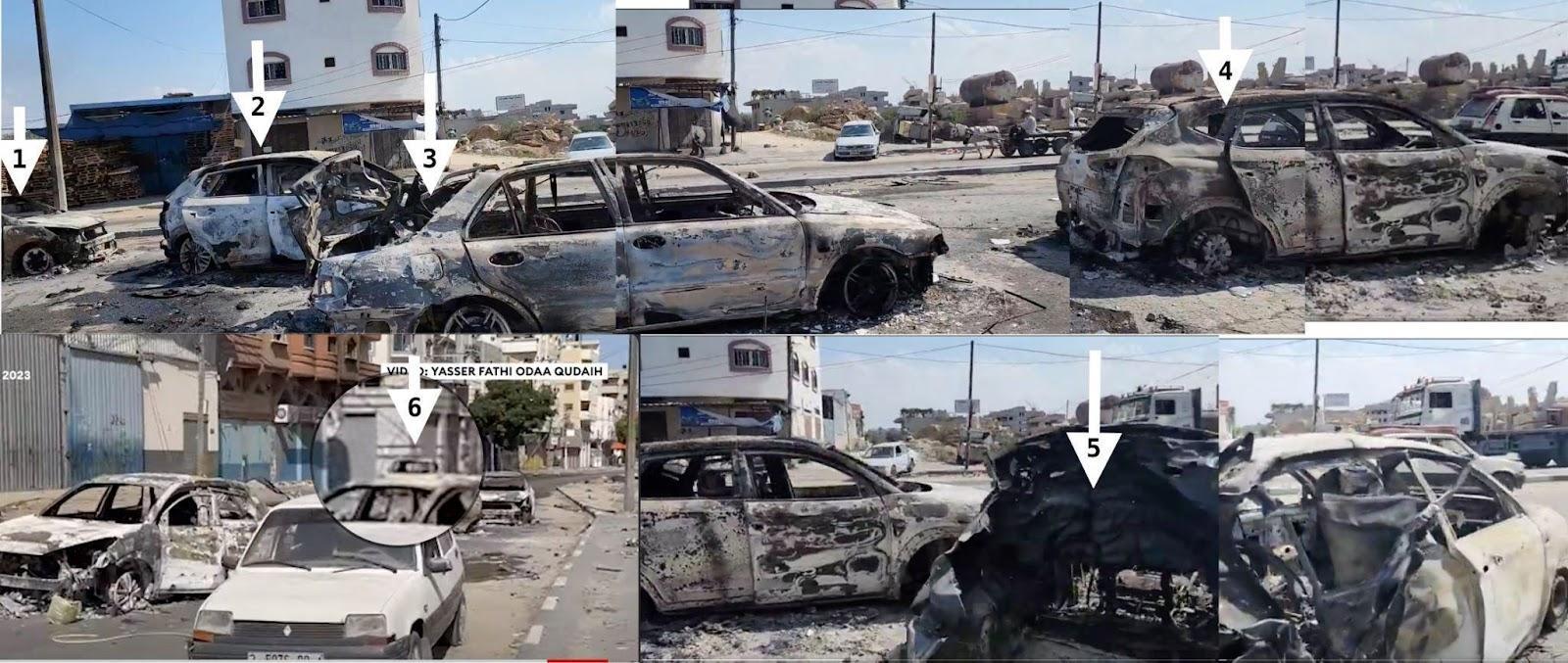
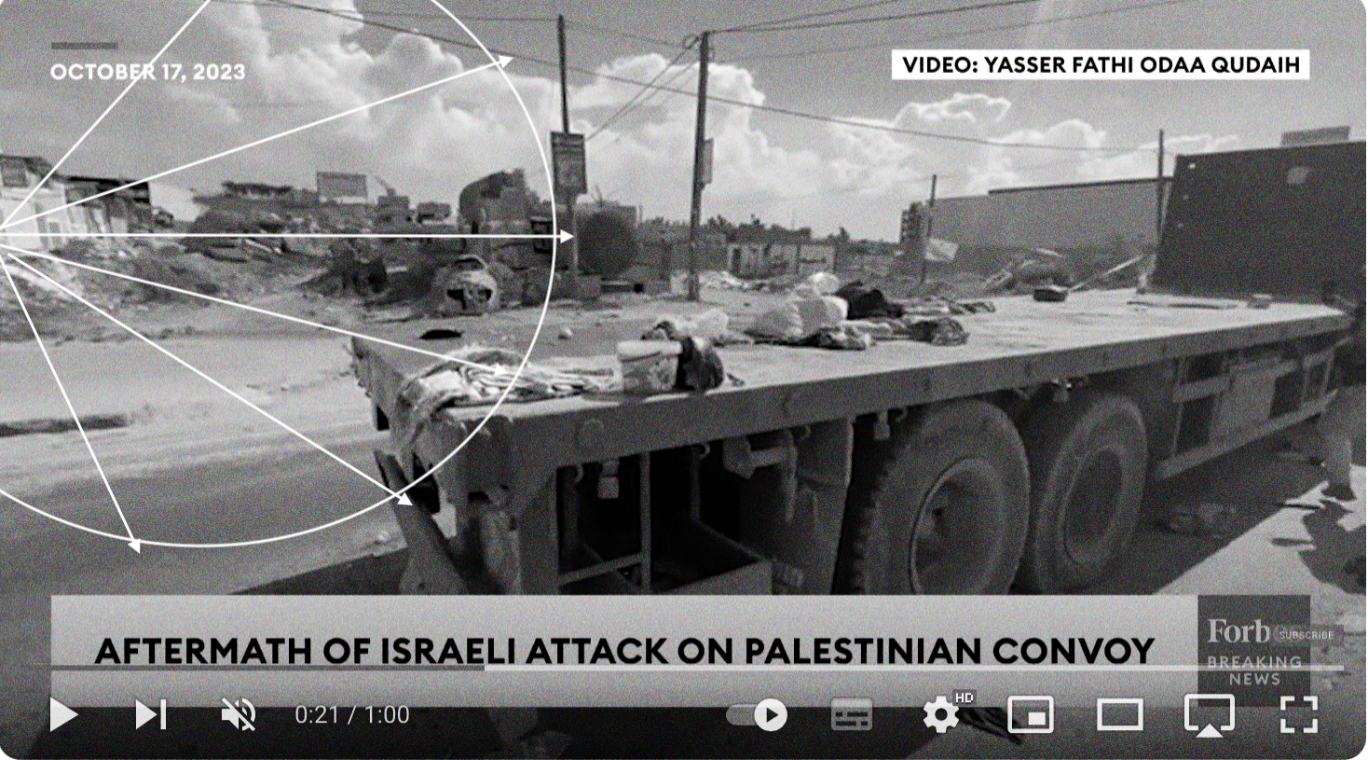
Two illustrative photos, a satellite image from Google Earth Pro. The locations of some shots that appeared in different videos and the order of the locations of the impacted parts along the impacted Salah al-Din Street. Photos from Forbes breaking news video, and the video of journalist Al-Zanoon. It shows the number of bombed and burned cars along the street. Photos were taken in October 2023.
Probable ammunition
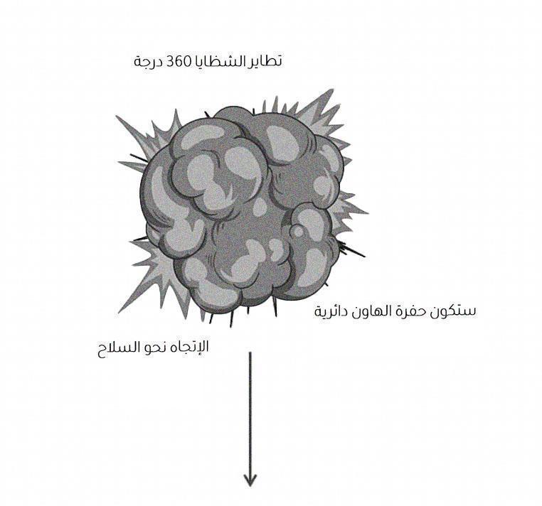
According to the video published by journalist Al-Zanoon on his Instagram account, which was taken a day after the incident, cars after they burned appeared. At second 9, ammunition remnants are seen on the ground that were relatively similar to the rear propeller of mortar shells. They are small in size and may belong to 81 mm or 82 mm mortar shells.
Researching the context of the use of this type of shells by both the “Israeli Army” and the forces of the armed Palestinian resistance factions within the scope of the incident, we found that the Israeli Army is using shells called M43 Mortar Bomb, i.e. M43 of 81 mm mortar. The shape of the tail propeller in the site in video of the incident matches the tail propeller of mortar shells used by the Israeli army.
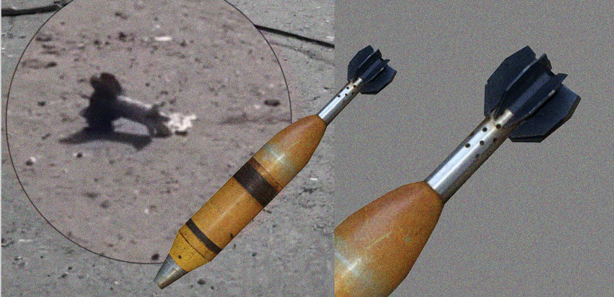
This type of shell falls typically with fragmentation at an angle of 360 degrees. This impact can be seen in video of bombed cars. The distribution of fragments on the wall of the ambulance.
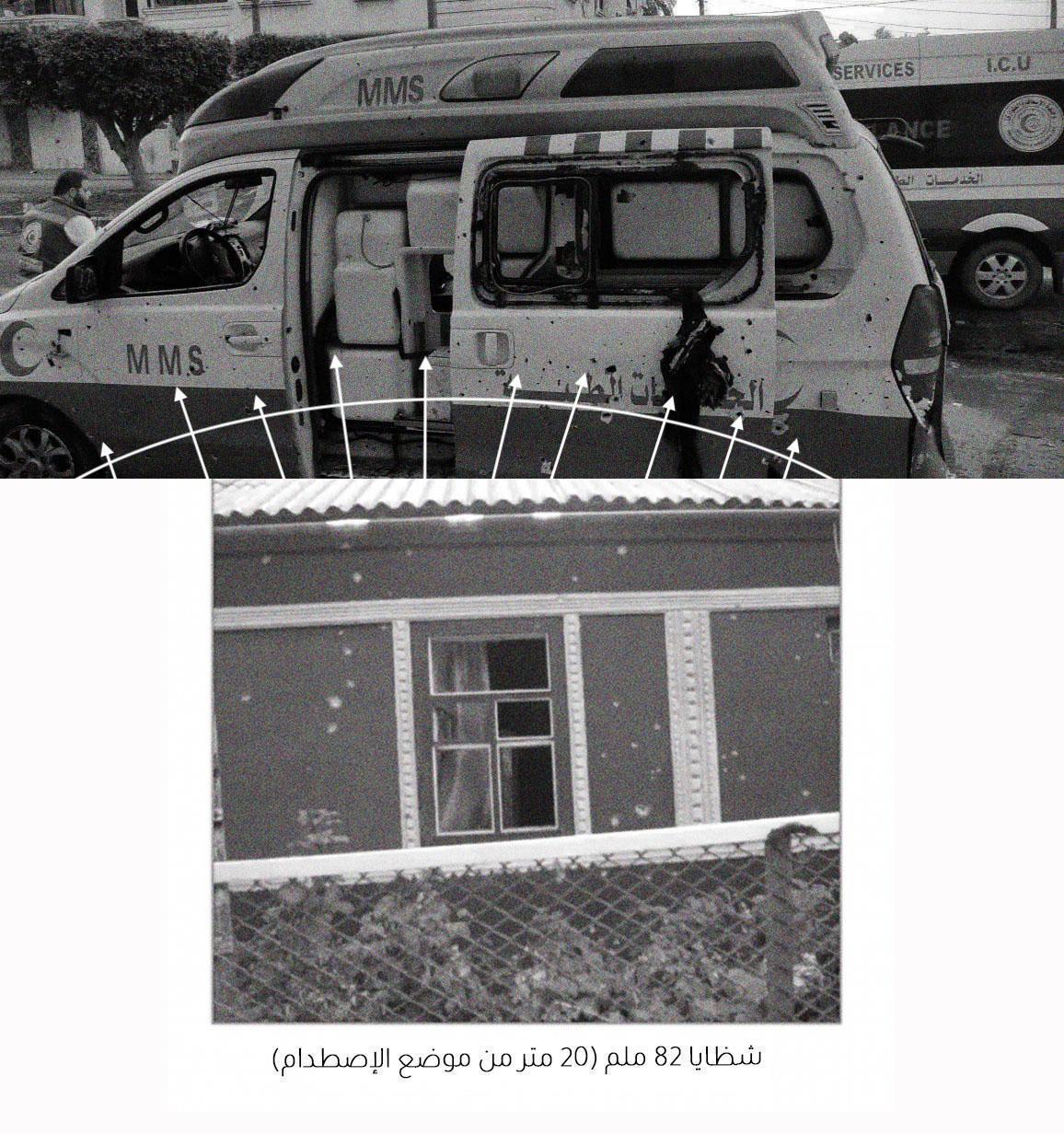
The analysis may take us back to the reason the rear trailer of the truck that was carrying the displaced people from the eastern side was damaged, as bloodstains and some corpses appeared on it despite the absence of a direct hit. It may be a result of being impacted by the fragments of a projectile that fell at a close range that was not noticed. The fragments of 81 mm mortar shells typically reach a radius of 20 metres.
Facebook user Mohammed Sirhan wrote that he was at the scene of the incident during the bombing, in a taxi carrying a family from Gaza towards the south, where the cars and displaced people who were walking on Salah al-Din street were bombed with artillery with several successive shells, adding that he survived, running away, leaving everything behind.
Mohammed’s account supports the possibility that the bombing was ground-to-surface and not an aerial bombardment. Returning to the possible munitions, this possibility can be assumed as well. In addition, the official spokesman for the Israeli army denied in an interview on Sky News on YouTube that there were air strikes on the area.
Based on the size of the impact and the direction and locations of the projectile’s fall, the likely direction of the projectiles’ arrival can be determined, which is the northeast of Gaza City from the direction of the settlements. The team searched for recent satellite images to determine the locations of the Israeli army in the northeastern settlements, but no photos were found that might help because they were encrypted on satellite images websites and included paid services at the time of writing the investigation.
This information is not an analysis produced by weapons experts, and therefore cannot be accepted as a final conclusion, and does not represent a claim by the authors of the investigation. It is an analysis of the data available so far.
Although there is a possibility that ammunition remnants may belong to any military forces within the permitted range for firing this type of shells, this cannot be confirmed yet. The ammunition remains are merely additional evidence that can be used in open source investigations, and other explanations for their presence at the incident site must be considered.
ــــــــــــــــــــــــــــــــــــــــــــــــــــــــــــــــــــــــــــــــــــــــــــــــــــــــــــــــــــــــــــــــ
- International law considers that a bombardment is indiscriminate if it “treats as a single military objective a number of clearly separated and distinct military objectives located in a city, town, village or other area containing a similar concentration of civilians or civilian objects” (API Art. 51.5.a). ↑
ــــــــــــــــــــــــــــــــــــــــــــــــــــــــــــــــــــــــــــــــــــــــــــــــــــــــــــــــــــــــــــــــ
Methodology
– Videos and photos published on social media and news websites on the day of the attack and in the following three days were collected, preserved, and analysed. Sources used in the investigation reached 32 in different media.
– Determining the date and time of the attack using advanced searches on X Invid, an open tool that extracts the date and time through reverse engineering, which confirms the local time when the first post about the attack was published, in addition to SunCalc, an open tool that determines the timing based on the length and direction of the shadow at the attack site, the results of which were consistent with the results of the first post published on X.
– Matching photos and videos published by users on social media websites that showed a truck with two trailers impacted by the attack, and there were several bodies in the site of the attack, in addition to a damaged ambulance on the side of the road, on Salah al-Din Street, and several cars appeared burning.
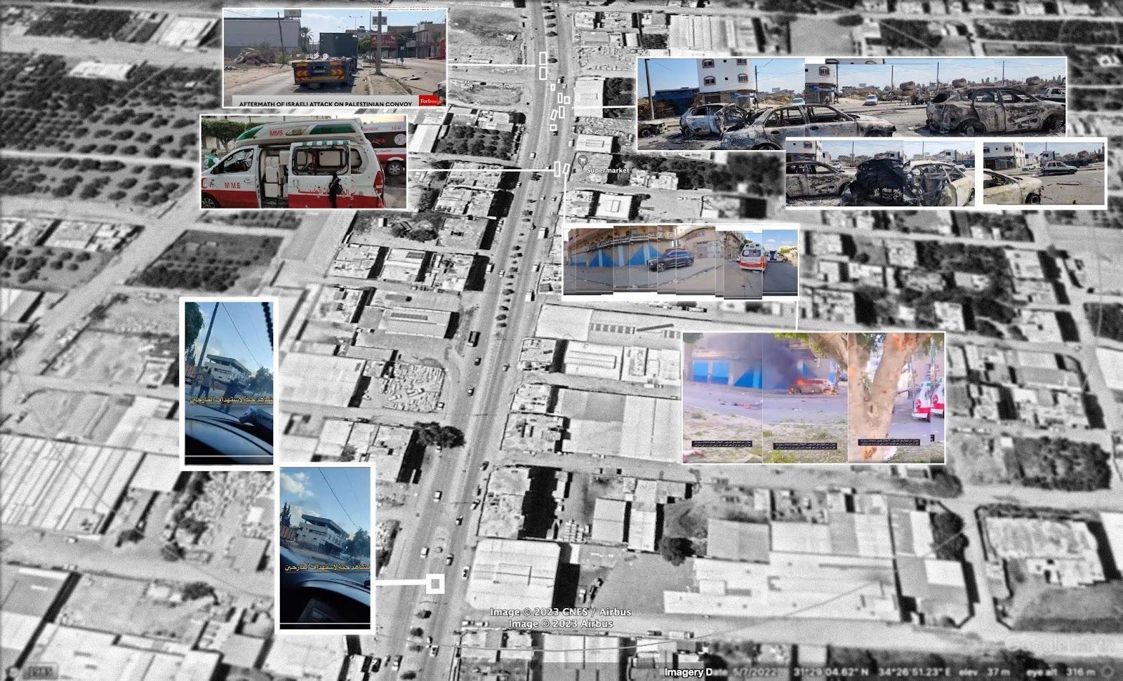
– Determining the geographical location of Salah al-Din street by searching for Salah al-Din street and street No. 10 in addition to the Gaza Valley Bridge in Open Street Map, which contains more accurate data than Google Maps and Google Earth of the names of local areas, then specifying a search range of 4.6 km around the area of attack and identifying distinctive visual identifiers such as shops that appeared in the visual content and comparing them to satellite images.
– Determining who is likely responsible based on an analysis of the trajectory of the ammunition and analysis of the penetration angles in the cars, as appeared in the location of the damage and evidence of the impact, the location of the cars in Salah al-Din street near Kuwait Roundabout, and information on areas of control.
This investigation is the result of multiple stages of analysis of available open-source information of the date, time, and location of the incident, as well as the munitions allegedly used and the party allegedly responsible for the attacks and resulting damage. Through examining all available information about the attacks, this investigation provides an understanding of the incident as well as the alleged perpetrators.